
Take a tour
Welcome to the AirMap tour. The screenshots and movies have been created to give you a first
impression of what AirMap is all about. If you would like a hands-on experience or more information, please
contact us for a demonstration on location.
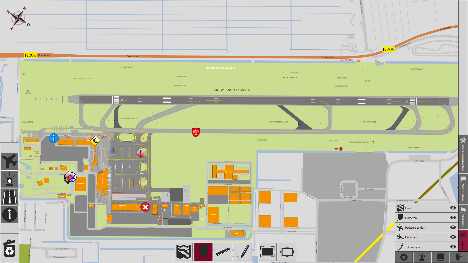
The situation at your airport at one glance
AirMap displays all relevant actual information on an interactive map of the
airport and its surroundings using symbols. It provides an instant overview of the situation,
improving the situational awareness of your staff and thereby increasing safety and
efficiency.
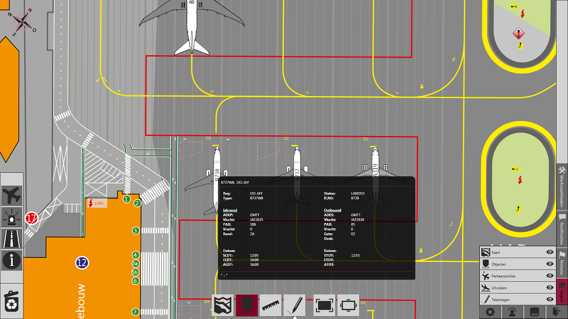
Information at your fingertips
The right information at the right moment and in the right form leads to
better, faster and more relevant decisions. AirMap makes this possible by providing a quick
overview using symbols to visualise special circumstances. When detailed information is needed, a
simple tap or click on the symbol will retrieve all available information.
Easy and intuitive control of the map
Working with AirMap is easy. It combines touch-interaction with easy to
interpret visualizations, making the platform intuitive and accessible to everyone. Basic
interaction requires no special training and the shallow learning curve minimizes the required
transition effort. The map can be manipulated with simple gestures for zooming, panning and
rotation.
Adding information is simple and effective
Anyone who has access to AirMap can add and instantly share information. By
simply selecting a symbol and placing it at the desired location on the map, information is shared.
By adding textual information to the symbol the information shared can be enriched. By again using
'drag and drop' an user can also move or remove information from the map.
Information is shared instantly
Information is shared instantly when a user or external system adds, updates or removes information. There is no delay in the timeliness of the information provided therefore all your staff will have the same operational picture avoiding miscommunication and improving overall efficiency.
No dedicated hardware required
AirMap is a windows application and can be used on any regular PC. Therefore
there is no need for dedicated hardware, keeping investment cost low. It furthermore enables users
to easily switch between applications without rebooting or changing from computer, saving time and
frustration.
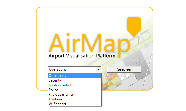
Personalised interface for every user or user group
Information needs are different for every user. Some users will only want to
monitor a specific area of the airport while others may also want to have an overview of the
surroundings. Or, some elements of the map are only important for specific tasks while it is a
distraction during regular tasks. AirMap lets its users create and store their own map view;
customised to their needs, showing only the information they need. These preferences are available
at any AirMap client by simply selecting the appropriate user.
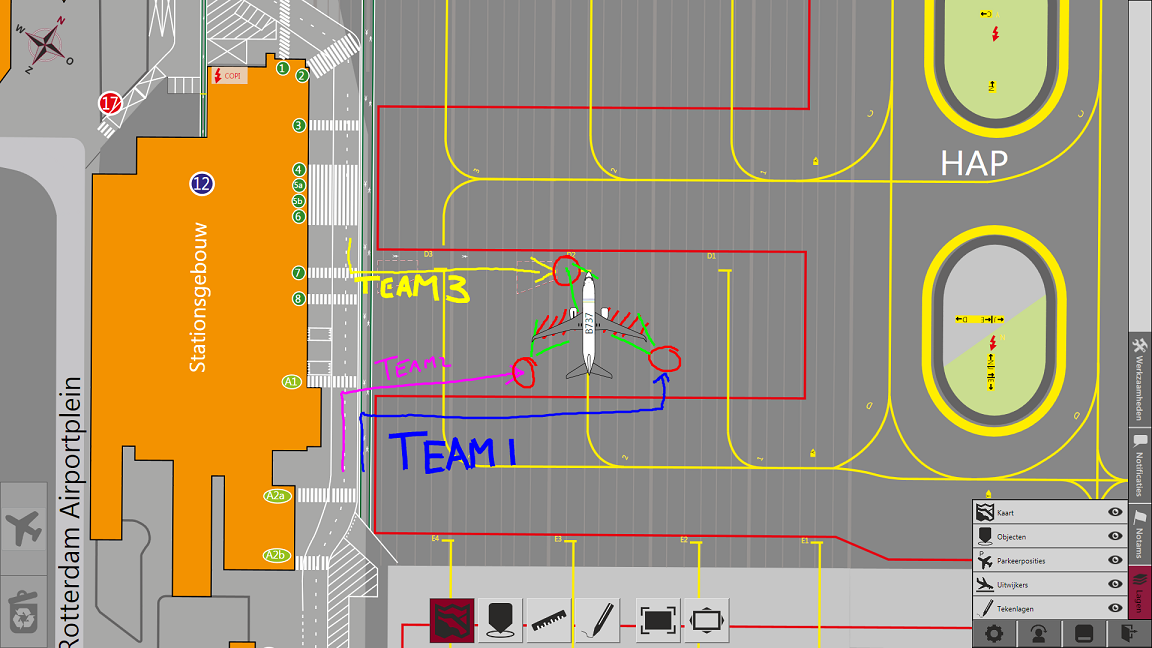
Every user has a personal drawing layer
Each user has an own drawing layer which is not visible for any other user.
This allows users to make notes to support their activities as they would normally do on a paper
map. This functionality can also be used to visually support instructions to visitors or
colleagues.
Maintain and update your own map
There are no extra costs involved to maintain your map in AirMap. The
settings menu is a place where authorized users can update the airport map. Simply modify your map
in your favourite graphics editor and load it in one of the AirMap clients and AirMap will
automatically distribute it to all other clients in your network.
Add your own symbols to AirMap
Not only the airport map can be maintained without additional costs, an
authorised user can add, remove or update symbols. Design your own symbols in any graphics editor
and load it into AirMap. By categorising symbols, even the object menu can be structured to the
preferences of the airport.